Coastal defence drone survey to be carried out

 Government of Jersey
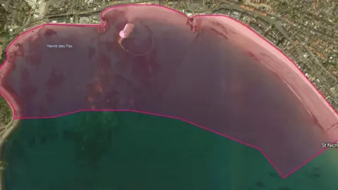
A series of drone topographic surveys are to be carried out in Jersey as part of the Shoreline Management Plan.
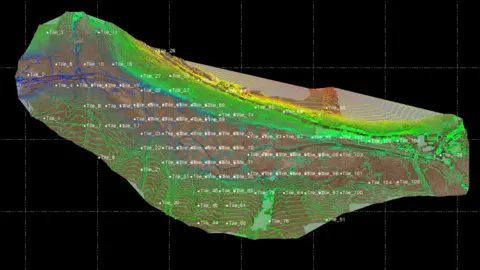
The surveys will map out coastal defences at Havre des Pas using the Point Cloud method, which creates a 3D representation of an area.
Millions of scan points will be recorded to create a 3D image of the defences and beach profile.
The drones will be active in the area from Monday until Friday from 05:00 to 11:00 BST each day.
 Government of Jersey
The government said only geographic terrain and structure data would be taken, and people would not be recorded by the scanning and data processing activities.
This survey will then be combined with existing assessments to inform the options for flood protection upgrades.

Follow BBC Jersey on Twitter and Facebook. Send your story ideas to channel.islands@bbc.co.uk.
