The Amazon's 'lost city' has been widely misunderstood. This is its true story

 Sofia Quaglia
This sprawling ancient metropolis in the jungle of Ecuador has revealed a unique form of urbanism found only in the Amazon. Sofia Quaglia visits the site for the story of this mysterious civilisation.
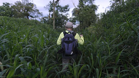
Archaeologist Alden Yépez hikes through a field of bright green grass, swinging his rusty machete left and right to carve a path in the shoulder-height tropical pasture. He's following his handheld GPS device with a certain haste: we must make it out of the grassland before sundown. At this pace, though, it takes just a swift 30 minutes to emerge from the body-slamming vegetation.
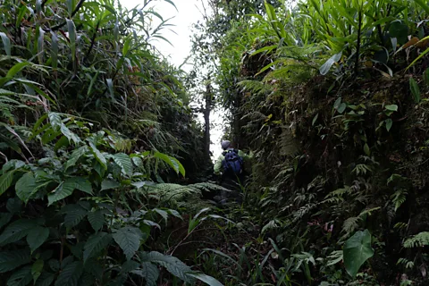
"We're here," he says, panting. He and I are now surrounded by small, steep hills forming something like a labyrinth around us. Once inside the system of formations, its man-made nature becomes clearer – amongst the tall grass there is a deep, long path and eight mounds organised in a geometrical pattern. One hill has a path sliced through it, and I see its interior of stratified mud with different shades of bright brown.
Yépez is an expert in ancient Amazonia from Pontificia Universidad Católica de Ecuador (Puce), and this is what is known as the Huapula Site. It is one of the densest networks of man-made mounds yet found inside Ecuador's so-called "lost city" of the Amazon – a sprawling system of dozens of such clusters.
Local archaeologists have known of some of these formations for 50 years, but the sheer scale of this 3,000-year-old urban landscape has only recently surfaced thanks to new mapping technology.
The discovery has helped upend the long-held idea that ancient Amazon-dwellers were only small groups of nomadic hunter-gatherers: instead reinforcing the theory that they were likely organised into sophisticated civilisations capable of creating complex urban networks.
However, as we learn more about these connected mounds, it's becoming clear they were not "cities" in the classical sense we understand them today, but rather a kind of urbanism unique to the Amazon jungle: low-density and multicentric, harnessing the strengths and weaknesses of the surrounding forest.
What is still unclear, though, is how and why this intricate world was made – and what will happen to it now that it's been discovered.
The urban Amazon
It was after a tip from a friend that Jesuit priest Pedro Porras started studying the first earthen platforms of Huapula in the valley of the Upano River of eastern Ecuador.
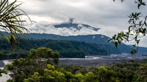
In 1978, under the shadow of the gurgling Sangay volcano, Porras spent more than 200 days digging up 15 different areas of the valley. One of his most famous excavation areas in the Huapula site is where he sliced open a large central mound to see the stratification of mud – the one Yépez and I walked through.
 Sofia Quaglia
In the 1990s, archaeologists began to expand on his work with other small, scattered excavations and preliminary attempts at mapping. Then, in July 2015, the Ecuadorian National Institute for Cultural Heritage (INPC) decided to map a 600 sq km (230 sq mile) area using light detection and ranging (Lidar) technology.
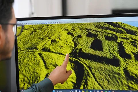
Technicians working for INPC flew over the valley in an aeroplane, shooting millions of laser pulses to the ground. Lidar uses ultra-thin light beams that seep through tiny gaps in foliage, bounce off the soil, and return reams of data that can be used to make intricate 3D maps of the ground.
It is several recent analyses of this data, released around a decade after these scans were first made, which have revealed that Porras' preliminary discoveries were part of a much larger picture than was previously appreciated.
The site contains a massive, sprawling network of almost 7,500 man-made structures, according to one of these analyses, published in 2023 by experts commissioned by the INPC. These include over 5,000 earthen platforms, around 1,500 hills and hundreds of rounded mounds, plaza-like areas, terraces and paths, roads, ditches and drainages.
The platforms were connected by trenches and roads and their use may have changed throughout the seasons, according to another analysis of the same data by French researchers in 2024.
A further team of archaeologists in Ecuador, led by Yépez, has created a publicly-available 3D mapping of the sites and is working on further analyses.
The ancient Amazonian inhabitants, it seems, were making huge, sophisticated urban areas, shaping the forest floor's mud to make hills and mounds atop of which to live on and congregate, as well as roads and potentially rivers to connect them.
A sprawling network
"It's pure compacted earth that they shaped, oriented and positioned," says Rita Litben, an independent researcher based in Guayaquil, Ecuador, and part of the two-person team commissioned by INPC to first analyse its data. "We're talking about natural elements that they modified into massive earthworks."
For centuries, it was assumed that before the 15th-Century arrival of the Spanish in Latin America, the Amazon's geography and climate meant it could only host small, scattered populations of hunter-gatherers. This was crystalised in the now-discredited theory of environmental determinism, popularised in the 1950s and 1960s by American archaeologist Betty Meggers, which said that the harsh and hot tropical climate of the Amazon would naturally undermine human progress.
But the recent Upano Valley findings add to a growing body of research using Lidar – with studies conducted in Brazil, Colombia and more – suggesting that the Amazon has actually long been the home of budding sophisticated civilisations systematically changing their landscape to fit their social needs.
"In light of this new technology, we have to rethink Amazonian settlements, we need to reconsider our perspective on what Amazonian populations really were," says Litben.
 Sofia Quaglia
The platforms throughout the networks are mostly organised in patterns of three to six units around a plaza-like space, often with another platform in the middle, the various analyses of the INPC data note.
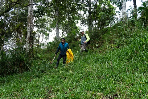
Most of these mounds – tolitas or montículos, as they are called by locals – are about 2-3m (7-10ft) tall and rectangular shaped, with sides around 10m (33ft) by 20m (66ft). The Amazonian civilisations likely lived on top of these smaller mounds, researchers suggest, because that's where archaeologists have found small remnants of everyday life objects like jars, grinding stones and cooked seeds.
But some networks are made up of much larger platforms, taller than 4.5m (15ft), sometimes even reaching 8m (26ft) and measuring as much as 40m (130ft) by 140m (500ft). This is where the Amazonians likely performed some form of ceremonial functions, the researchers suggest, because archaeologists have not found much trace of human activity or food.
"Lots of people were needed to create those platforms, there were many people living there, many people working, and many people transforming the jungle," says Alejandra Sánchez Polo, an archaeologist at the Universidad de Valladolid in Spain and the other co-author of the INPC analyses.
Several of the experts are now trying estimate possible population sizes – working backwards from the mounds and calculating how much soil each person could have transported per day to make so many of them. Nobody feels comfortable putting a number on it yet though.
"It was a big surprise to see the extension of these cities," says Stéphen Rostain, a longtime Upano archaeologist and director of investigation at the French National Centre for Scientific Research. "Some say 10,000, 30,000, 100,000, but I cannot say anything without serious data that can prove it."
An 'almost perfect' checkerboard
Rostain's work suggests that the mound networks were interconnected by a sophisticated road system. The dug paths were anywhere between 2-15m (7-49ft) wide and 5m (16ft) deep. They could run as long as 25km (16 miles) and may have connected the networks to other communities in the valley, likely for trade.
The roads are also surprisingly straight, despite the natural irregularities of the terrain. "We never imagined before that it was possible to get such a large site organised in a checkerboard, it is almost perfect," says Rostain.
Rostain suggests there were also agricultural fields extending over hundreds of square metres in geometrical plot systems with intertwined small drainage canals and terraces.
 Sofia Quaglia
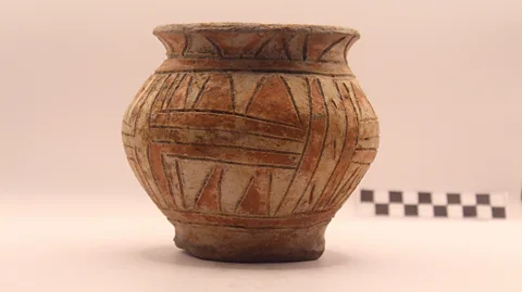
In the highly fertile soil of the area, the Amazonians cultivated maize, beans, manioc and sweet potato, according to his examination of starch grains found in uncovered ancient potteries. They drank chicha, a fermented maize drink still popular today, and, given how many fragments of drinking bowls Rostain has uncovered in his years excavating the surrounding Upano areas, he speculates that collective drinking ceremonies were likely very common.
"The Amazon was not the end of the civilisation, it was the cradle of civilisation," says Rostain.
Don't call them 'cities'
Rostain's paper on the Upano Valley made a massive media splash when it was published in 2024. But it also received some criticism for possible inaccuracies, especially by Yépez's team, and for not adequatelycrediting the work of Litben and Sánchez-Polo, among other things.
Rostain fervently rebukes Yépez's teams' criticisms and says he didn't know about the INPC-commissioned analysis by Litben and Sánchez-Polo (which was published in Spanish) while writing his own.
The wide-spanning news coverage saw Upano Valley's earthen formations garner the nickname of the "lost cities of the Amazon" and the journal Science featured Rostain's paper on its front cover with the words "lost city". But the designation left some experts uneasy. In a 2025 paper, Kathryn Reese-Taylor, an anthropologist at University of Calgary in Canada, examined the way the media has overhyped several Lidar findings, including those in Upano Valley.
The word "lost", she notes, implies something is "no longer known" or "ruined or destroyed". But locals and local archaeologists knew and studied the mounds well before the new Lidar work, albeit not fully grasping the scale of their networks. Comparisons with Rome, reported in media including the BBC, she writes, impart a grandiosity on the findings, noting its size "hardly compares with Rome".
Rostain for his part insists his research never drew comparisons with Rome or described the discovery as a "lost city".
Some even argue calling the Upano Valley's network of mounds a "city" could be doing it a disservice.
"They're kind of like the alter ego of European city-based urbanism, in the sense they're multicentric, low density, and so… a form of urbanism without cities," says Michael Heckenberger, an anthropologist at the University of Florida. Heckenberger was not involved in the Upano Valley studies but researches Amazon urbanism in Brazil and has popularised the terms "garden cities" and "galactic urbanism".
 Getty Images
"All of a sudden, the Amazon is showing us an alternative form of urbanism that isn't, you know, in an evolutionary sense beneath European cities, it's a different type of urbanism, equally complex," he says. Heckenberger notes, though, that Upano Valley lies very close to the Andes and has a unique topography, so shouldn't be touted as a model of all Amazonian urbanism.
And there is still plenty left to uncover about how this ancient urbanism may have worked.
An unfinished puzzle
In the car ride between visits to the mounds, Jonathan Panimboza Deleg, a geographical and environmental engineer analysing the data on Yépez's team at Puce, shows me a live 3D render of the Upano Valley on his computer. Pointing to a cluster of small pyramid shapes, he says they could be montículos, but the Lidar data isn't complete enough to tell just yet. He says as many as 90% of these data points are still unclassified and could reveal even more segments of the network.
The current results also represent only part of the full Upano system, with only half of the area scanned by the INPC studied so far. Rostain says the INPC has released the remaining data to him, which he'll use to expand his 2024 analysis over the larger territory.
Yépez and Panimboza Deleg have another theory about what the mounds and plazas of the Upano valley were additionally used for: water management.
 Sofia Quaglia
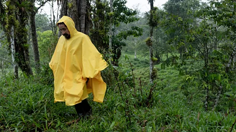
On one of my days out with them looking for montículos hidden in the tall grasses, the rain drenched us non-stop for hours, with rivulets sweeping under our rubber boots and the mud coming up to my knees. This climate is why the two researchers theorise that the networks of mounds may have actually been designed as "osmotic cities". Rather than roads, many of the trenches could have been drainage canals that would fill up like rivers and channel the water according to the society's needs during the periods of heavy rain. The plazas may have been water reservoirs, Yépez adds.
This theory would be "even more of a testament to how skilled the Amazonian people were at adapting", says Yépez. His research team is now working to corroborate this hypothesis.
Rostain, however, calls this theory "ridiculous" and unfounded – while the climate was humid and wet, he says, this was not to a problematic extent, and there was no obvious need for massive water‑management systems.
Who built these cities?
It's still unclear when these mounds were first created. In interviews, the French team, the INPC-commissioned team and the Ecuadorian team led by Yépez all tentatively suggest around 3,000 to 2,500 years ago.
Crucially, it's also unknown whether the mounds were all built and inhabited at the same time. Lidar provides a flattened screenshot of what structures remain now; it doesn't tell us when they were made or how long they were used for. If they were all built and inhabited simultaneously, it would mean the civilisation was large, highly sophisticated and likely organised with some form of management structure. Building them slowly, a few at a time, would have required far less organisation and a smaller workforce.
It's also not known whether the settlements had a large permanent residential population or was more about large numbers of people coming and going for ceremonial activities, for instance, says Yépez.
 Museo Gonsha/Doménica Ortega
He suggests the structures could have been made to mimic hummocks: small, natural deposits formed from the debris of the nearby Sangay volcano. He thinks the Amazonians likely first used the hummocks as platforms for their homes and then decided to try to replicate them as their populations grew. "They were looking for the most optimal in natural landforms," says Yépez.
Other researchers have examined the extent to which the ancient Amazonians cut down or built around the forest, and how much they farmed the land around them. "These forests can heal themselves remarkably quickly, which is why it's quite difficult to tell where people have been in the past," says Mark Bush, a palaeoecologist from Florida Institute of Technology. The Upano valley vegetation we see today, he says, comes from changes in the past 200 or 300 years, not ancient times.
Exactly what type of society lived on these mounds and what their culture was like also remains a mystery.
Why did the Amazonians leave?
We don't yet know what happened to the society that once lived atop of these mounds. Rostain's studies suggest the sites were "briskly" abandoned by the Upano – the name given to the original mound-builders – in AD300, likely due to the Medieval Climate Anomaly which dried out much of the Andes at this time. They were likely then succeeded by the Huapula peoplein AD600, he says, a smaller and less productive civilisation who remained until at least the 13th Century.
"Little has been done in terms of more anthropological questions," says Florencio Delgado, a professor of anthropology at the Universidad San Francisco de Quito who is among the Ecuadorian team now studying the montículos. It could be theorised that to move these massive amounts of soil, there must have been some top-down management, a plan and some form of chiefdom, he says.
"There are still a lot of things missing in the picture,” says Delgado. One glaring problem is that there are barely any traces of the humans who actually lived there. Excavations in the area are yet to find any burial grounds, or any skeletons at all. "One of the most important questions for me is, where are the people?" says Delgado.
Not so 'lost' after all
In the "lost city" rhetoric that has enveloped this Amazonian urbanism, the mound networks are often described as if they were hidden from the world, far away from civilisation, shrouded under the thick humid canopy of the jungle, where no one would have ever found them.
That’s not accurate, though. Like in ancient times, much of the Upano Valley is currently settled by humans.
While the montículo complexes are officially under the protection of the INPC, many are on people's private land. To access the mounds while on our archaeological explorations, we had to ask local farmers for permission to hike their grounds, dodge their cows and jump over their electrified fences.
 Sofia Quaglia
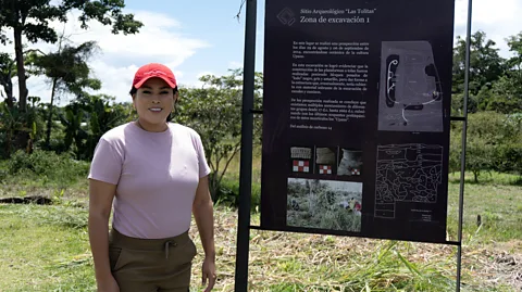
Some farmers are upset that they cannot properly sow their land and routinely attempt to destroy the montículos on their soil, according to Carmen Quito, who manages the 1,450 hectares (3,580 acres) of farmland area which enclose the Huapula complex. But other locals, Quito included, are proud of the archaeological discoveries and work hard to protect them.
In Morona, a province with jurisdiction over more than 5,300 of the mounds catalogued so far, a group of seven local history buffs have started an independent, volunteer warden programme to safeguard the mounds. A motley crew – a data scientist, an architect, a tourism guide and a designer, among others – they call themselves the Guardians of Patrimonies. Since summer 2025, they have worked to systematically report any mound destruction to authorities, educate local landowners on the history of the mound network and organise tours for curious newcomers.
More like this:
In Pablo Sexto, a town in the province, a small archaeological park has been built to celebrate its mounds. Situated right by the town's central square, it contains three big ancient mounds beside large white plastic letters spelling the word tolitas and signposts with historical information.
Yajaira Ramón Rodas, the town's mayor, says she believes that in time the tolitas will bring benefits to the area's present-day residents. "[W]e always say to our citizens, 'Here you are going to have something of great value.'"
--
If you liked this story, sign up for The Essential List newsletter – a handpicked selection of features, videos and can't-miss news, delivered to your inbox twice a week.
