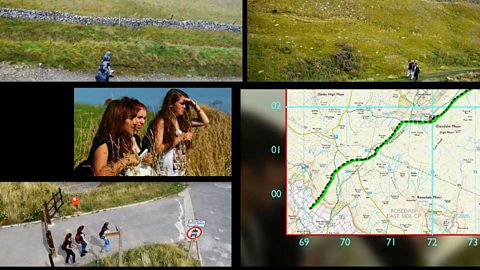
This clip demonstrates how to use co-ordinates or grid references to calculate position on a map.
Video
KS3 Geography. Maps and navigation.
Co-ordinates and grid references.
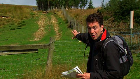
JOE CROWLEY: When you need to find out exactly where you are on a map you can use co-ordinates to pinpoint your location.
When we’re out walking we use different types of co-ordinates depending on the situation we’re in. They’re especially useful when there are few obvious features to help you locate a place.
One set - called latitude and longitude - allows us to pinpoint exactly where we are anywhere in the world. Latitude indicates how far north or south you are. It’s traditionally been measured in degrees, minutes and seconds - although decimals are sometimes used instead. The numbers are accompanied by either north or south depending on where you are relative to the equator, which is at zero degrees. Britain is north of the equator between about 50 and 60 degrees.
Longitude tells you your position relative to the prime meridian which runs through Greenwich in London. For this measurement again degrees, minutes and seconds - or decimals - are used and it’s accompanied by east or west depending on which side of the prime meridian you are. Combine the two and you can pinpoint an exact location.
Latitude and longitude are often the default co-ordinates used by GPS devices and they’re great for working out where you are on a global scale. But there’s an alternative way that’s usually employed when using an Ordnance Survey map.
Latitude and longitude are marked on this map but they’re not always that easy to use. Instead, grid references can be much more useful.
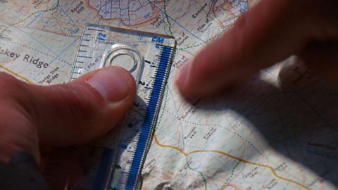
If we’re using a map then we usually use a grid reference which is six figures long preceded by two capital letters. An example would be the grid reference SD886872. But what does this mean?
Well the letters give us a very broad indication of where someone or something is. For mapping purposes the UK is divided into separate 100km squares. The letters in our co-ordinates tell us which one of these squares we’re in. They can be found on the top of Ordnance Survey maps.
Each of these sections is then broken down into further 1km squares marked by blue lines on maps and referenced by numbers on the top of the map called eastings and on the side which are called northings. When we quote a grid reference eastings always come first. In our case we have 88 referring to a major blue line. Then we hone in using decimal places with the 6. So the line for 886 is six-tenths of the way from the line marked 88 towards the line marked 89.
We do a similar process with the northings. With our grid reference we go from the horizontal blue line marked 87 and travel two-tenths of the way towards 88. Our location is where the eastings and northings intersect.
A six-figure reference gives us our position within 100m. A GPS device typically uses a ten-figure reference, which narrows locations down to the nearest metre, although they’re not always completely accurate.
So whether you’re using a GPS device or you’ve arranged to meet someone at a particular point on a map knowing how to use co-ordinates can be essential.
Download/print a transcript of the video.
Joe Crowley explains how co-ordinates can be used to help pinpoint an exact location on a map.
He explains that there are different types of co-ordinates and demonstrates how latitude and longitude can be used to plot a position anywhere on earth. Degrees, minutes and seconds are used, as well as digital forms to express latitude and longitude. Latitude is plotted according to your position relative to the equator, whereas longitude is plotted according to your position relative to the prime meridian at Greenwich. Latitude and longitude are used by GPS, or Global Positioning Satellite, technology.
Joe explains that a system that’s often used as an alternative to latitude and longitude when navigating using Ordnance Survey maps is a system called grid references. This uses a six figure eastings and northings method. Joe shows how the grid references work to plot a position within 100 metres.
This clip was originally from the series Get Lost.
Teacher notes
Download/print the Teacher Notes for this episode (pdf).
Before watching the video
Ask students how features can be located on a map. Show students a range of different maps at different scales, for example a 1:25,000 map and a map of the world. Ask students if how they would find a location would differ between the maps.
Introduce key terms such as:
Latitude: The angular distance from the equator.
Longitude: The angular measurement from the Prime Meridian in Greenwich, London.
GPS: Global positioning system. A satellite-based navigation system that enables users to determine a location.
Grid reference: A system used to pinpoint locations on a map by using eastings and northings.
During the video
You may wish to stop at relevant points during this short film to pose questions and check understanding or wait until the end.
Useful questions might include:
- What are latitude and longitude and why are they important?
- What is the prime meridian?
- What is a GPS device used for?
- What are grid references?
- How much area does one grid square cover?
- What are northings and eastings?
After watching
Use OS maps with your class asking them to pick out different locations on the map using grid references. Four-figure grid references could be used first and then six-figure grid references once students feel more confident. Students could then pick out 10 grid references on the map to test their peers with.
Students could also plan routes between two locations using grid references. They could describe the route between the two using geographical vocabulary, including compass directions.
1:25,000 and 1:50,000 maps could be used to show the differences in scale and how grid references can be used in the same way across both scale maps.
Where next?
The Ordnance Survey website provides a great opportunity to practice different skills and gain helpful hints and tips on all aspects of map reading.
Curriculum notes
This clip will be relevant for teaching Geography.
This topic appears in OCR, Edexcel, AQA, WJEC KS4/GCSE in England and Wales, CCEA GCSE in Northern Ireland and SQA National 4/5 in Scotland
More videos from this series
Using maps to calculate distance. video
Demonstrating how to use the scale of a map to work out distances.
Contour lines and gradients. video
Demonstrating how contour lines can be used to understand gradients.
Public rights of way. video
Explaining how to use maps and signposts to work out public rights of way.
What is 'geocaching'? video
Geocaching - a high-tech treasure hunt anyone can play with a smartphone.